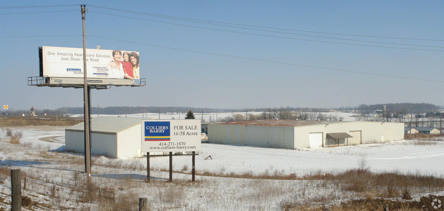
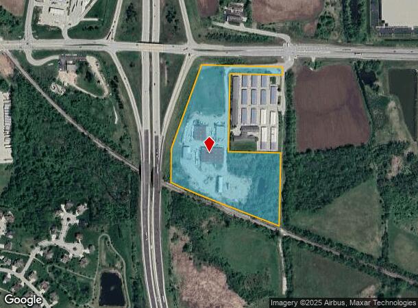
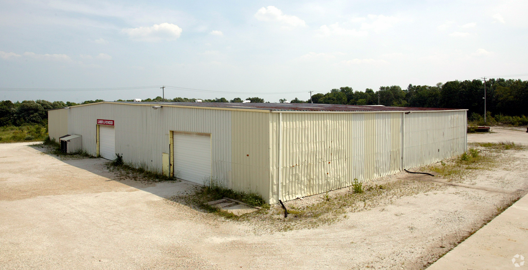
Property Record
N128w21795 Holy Hill Rd, Richfield, WI 53076
NEARBY LISTINGS FOR SALE OR LEASE
Property Detail
N128w21795 Holy Hill Rd
Milwaukee-Waukesha-West Allis, WI
Csm No. 6264
GTNV-182987
PT W1/2 NW CSM 6264 LOT 2 DOC 1152062+1188390
Commercialnec
Washington
X
Wisconsin
55131C0356F
2
2023
15.85 AC
2023
Washington East
470100
Milwaukee/Madison
DEMOGRAPHICS near N128w21795 Holy Hill Rd
1 Mile
3 Mile
5 Mile
2024 Total Population
717
8,440
29,811
2029 Population
732
8,532
29,810
Pop Growth 2024-2029
+ 2.09%
+ 1.09%
0.00%
Average Age
44
44
43
2024 Total Households
275
3,354
11,946
HH Growth 2024-2029
+ 1.82%
+ 1.01%
(0.17%)
Median Household Inc
$98,797
$97,583
$100,898
Avg Household Size
2.60
2.50
2.50
2024 Avg HH Vehicles
2.00
2.00
2.00
Median Home Value
$349,218
$349,497
$341,545
Median Year Built
1977
1979
1984
Nearby Places
- Restaurants
- Banks
- Shops
- Fitness
- Groceries
PUBLIC TRANSPORTATION
AIRPORT
General Mitchell International
DRIVE
WALK
Distance
General Mitchell International
46 min
31.5 mi
Freight Ports
Port Milwaukee
DRIVE
WALK
Distance
Port Milwaukee
40 min
27.7 mi
Nearby Properties
Address
Land Use
TOTAL SIZE
Lot Size
Zoning
Address
Land Use
TOTAL SIZE
Lot Size
Zoning
706,000 SF
39.22 AC
Address
Land Use
TOTAL SIZE
Lot Size
Zoning
32.89 AC
Address
Land Use
TOTAL SIZE
Lot Size
Zoning
240,468 SF
20.03 AC
Address
Land Use
TOTAL SIZE
Lot Size
Zoning
204,373 SF
16.50 AC
Address
Land Use
TOTAL SIZE
Lot Size
Zoning
203,580 SF
13.52 AC
Address
Land Use
TOTAL SIZE
Lot Size
Zoning
198,648 SF
16.57 AC
Address
Land Use
TOTAL SIZE
Lot Size
Zoning
104.57 AC
Address
Land Use
TOTAL SIZE
Lot Size
Zoning
146,022 SF
8.51 AC
Address
Land Use
TOTAL SIZE
Lot Size
Zoning
Address
Land Use
TOTAL SIZE
Lot Size
Zoning
100,000 SF
13.07 AC
Address
Land Use
TOTAL SIZE
Lot Size
Zoning
28,840 SF
12.02 AC
Address
Land Use
TOTAL SIZE
Lot Size
Zoning
10.93 AC
Address
Land Use
TOTAL SIZE
Lot Size
Zoning
130,000 SF
12.76 AC
Address
Land Use
TOTAL SIZE
Lot Size
Zoning
17.74 AC
Address
Land Use
TOTAL SIZE
Lot Size
Zoning
151,245 SF
17.54 AC
Address
Land Use
TOTAL SIZE
Lot Size
Zoning
67,200 SF
5.90 AC
Address
Land Use
TOTAL SIZE
Lot Size
Zoning
5.35 AC
Address
Land Use
TOTAL SIZE
Lot Size
Zoning
10.32 AC
Address
Land Use
TOTAL SIZE
Lot Size
Zoning
18.39 AC
Address
Land Use
TOTAL SIZE
Lot Size
Zoning
18.33 AC
Address
Land Use
TOTAL SIZE
Lot Size
Zoning
Address
Land Use
TOTAL SIZE
Lot Size
Zoning
Address
Land Use
TOTAL SIZE
Lot Size
Zoning
14.19 AC
Address
Land Use
TOTAL SIZE
Lot Size
Zoning
28,800 SF
3.51 AC
Address
Land Use
TOTAL SIZE
Lot Size
Zoning
33,920 SF
5.17 AC
Address
Land Use
TOTAL SIZE
Lot Size
Zoning
Address
Land Use
TOTAL SIZE
Lot Size
Zoning
15,822 SF
6.72 AC
Address
Land Use
TOTAL SIZE
Lot Size
Zoning
Address
Land Use
TOTAL SIZE
Lot Size
Zoning
Address
Land Use
TOTAL SIZE
Lot Size
Zoning
2.93 AC
The World's #1 Commercial Real Estate Marketplace
Connect with us
© 2025 CoStar Group
The information above has been obtained from sources believed reliable. While we do not doubt its accuracy we have not verified it and make no guarantee, warranty or representation about it. It is your responsibility to independently confirm its accuracy and completeness. Any projections, opinions, assumptions, or estimates used are for example only and do not represent the current or future performance of the property. The value of this transaction to you depends on tax and other factors which should be evaluated by your tax, financial, and legal advisors. You and your advisors should conduct a careful, independent investigation of the property to determine to your satisfaction the suitability of the property for your needs.